 |
||||||||||||||||||||||||||||||||||||||||
 |
||||||||||||||||||||||||||||||||||||||||
|
Please Read the Guestbook |
||||||||||||||||||||||||||||||||||||||||
 |
||||||||||||||||||||||||||||||||||||||||
|
Please Sign the Guestbook |
||||||||||||||||||||||||||||||||||||||||
|
|
||||||||||||||||||||||||||||||||||||||||
 |
||||||||||||||||||||||||||||||||||||||||
|
Wagonteamster |
|||||||||||||||||||||||||||||||||||||||||||||||||||||||||||||||||||||||||
|
Summary |
|||||||||||||||||||||||||||||||||||||||||||||||||||||||||||||||||||||||||
|
On June 30, 2016, myself and a group of five friends and family undertook a twelve day kayaking adventure in the West Arm of Glacier Bay, Alaska. My brother Jim and I had made a similar trip ten years ago with another group of four friends and family. On a scale of one to 10, this expedition was definitely pushing hard on being a perfect ten. The weather was as perfect as it gets in Southeast Alaska, it was a great bunch of guys and the wildlife was up-close and plentiful. |
|||||||||||||||||||||||||||||||||||||||||||||||||||||||||||||||||||||||||
 |
|||||||||||||||||||||||||||||||||||||||||||||||||||||||||||||||||||||||||
|
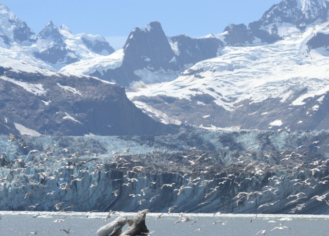
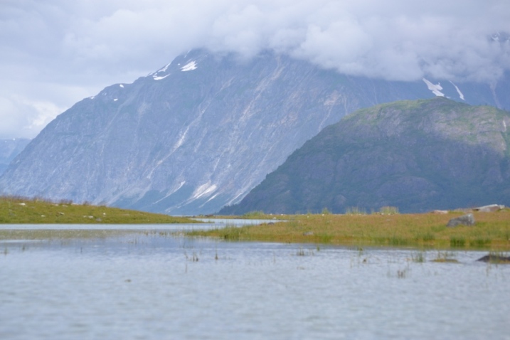
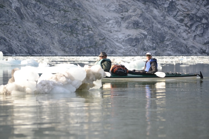
Advancing at a rate of 6 feet per day, John Hopkins Glacier sheds a lot of ice into the narrow rocky fjord of John Hopkins inlet. Each year, Arctic Terns fly from the Arctic to the Antarctic and back again. Located about a mile beyond the terns is the mile wide, 200 to 400 feet tall glacier. |
|||||||||||||||||||||||||||||||||||||||||||||||||||||||||||||||||||||||||
 |
|||||||||||||||||||||||||||||||||||||||||||||||||||||||||||||||||||||||||
|
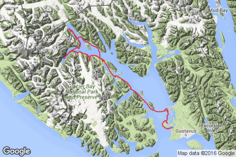
Unlike most kayaking trips in Glacier Bay, our journey started by kayaking north to the glaciers from a starting location at the park headquarters in Bartlett Cove (near Gustavus, AK) before returning in a motorized, catamaran, pickup boat. To provide some scale. the two large fjords at the upper-left side of the map are about 70 miles from the starting point. Before pulling out at the end of the trip, we managed to Kayak 127 miles in 11 days, visiting 4 out of the 5 tidewater glacier in the bay, as well as Reid Glacier which stops just shy of the ocean. |
|||||||||||||||||||||||||||||||||||||||||||||||||||||||||||||||||||||||||
|
Camping Locations & Itinerary: |
|||||||||||||||||||||||||||||||||||||||||||||||||||||||||||||||||||||||||
|
Night 0, 6/29/16 – Bartlett Campground. Arrive about 6:00 pm attend NPS briefing (they try to leave for the night by 7 pm), then camp in campground. Day 1 6/30/16 - 9 am kayak briefing, then, since we missed the high tide to the Lester Island Cut (11 feet on the Bartlett Tide table is needed for the passage) we had to go west and take the Beardslee entrance at 4:30 pm Low-Slack tide to enter Secret Bay for the night. Night 1 – Secret Bay, Beardslee Islands. Very Good Camping place - bring water with you. Day 2, 7/1/16 - Explore Beardslee Islands, Night 2 - Camp on the old Fox Farm Island (in the northwest corner of the Beardslee Islands), poised for Low Slack Tide crossing of Narrows at 6:24 am the next day. Poor Camping place - a long, rough carry at low tide. Bring water with you. Day 3, 7/2/16 – Up early in the morning to cross the Sitakady Narrows to the west side of the bay at low slack tide, then kayak to Geike Inlet on the flood tide. Night 3 – North side of Geike Inlet. Very Good Camping place - good salmon stream, Dolly fishing. Day 4, 7/3/16 – Leave camp by 8:00 am, need the whole flood tide to reach the Skidmore Cut by the approx. 3 pm high tide. (Note- to prevent having to portage the cut, 15.2 feet high tide, as shown on the Willoughby Tide Chart is needed. High Tide is 1/2 hour past the time on the Willoughby Chart). Night 4 – Camp at a nice creek 2 miles west of the Skidmore cut. Good Camping Location - small run on salmon stream. (Note - the pink salmon hadn’t began their spawning run at the time of this trip. They usually start running in the Glacier Bay steams about July 21 to July 28) Day 5, 7/4/16 – Cross the West Arm at 9 am low tide, then travel west to camp ashore at a location almost even with the West side of Russell Island. Very Good camping location in strawberry patch, just past a few willows next to the beach. Day 6, 7/5/16 – Leave camp at approximately 10:15 am low tide and travel west up Tarr Inlet. Night 6 – Camp 1 mile east of Margerie Glacier (on the same side), at the inlet due east of the glacier the south shore. Note - to avoid a long put in or take out, land here at high tide and take out at high tide only. Otherwise, it’s about a 300 0r 400 yard pullout. (note - it’s the only decent place to camp around there). Day 7, 7/6/16 - Leave camp at 5:00 am and travel east down the inlet on the ebb to travel to the camping location. Night 7 – Camp across the bay from Lamplugh Glacier. Almost directly across from the Glacier is the only decent camping place between there and the black sand beach in John Hopkins inlet. Day 8, 7/7/16 – Travel up the John Hopkins Inlet to the black sand beach, about 1 mile short of the John Hopkins Glacier (on the right side). This a very nice camping place and the only place in John Hopkins Inlet. Bring water with you. The only local water is glacial fed and muddy. Travel in and out of the inlet depends on the ice conditions but you can usually pick your way through. Day 9 7/8/16 – Leave camp at 5:45 am high tide and use the ebb to travel down the inlet. Make camp at Ptarmigan Creek before 12:19 pm high tide. Night 9 – Ptarmigan Creek. Day 10, 7-9-16 Explore Reed Glacier Inlet, glacier and Ibach cabin site. Night 10 – Continue to Night 4, 10 campsite. This should be about two miles from the pickup location, which is 1/2 west of the Skidmore Cut. Day 11, 7-10-16 Travel to pickup location. Be there by 10:30 am (the boat pulls in for the pickup at 1 pm). Turn in Kayaks and bear canisters when back in Bartlett. Night 11 – Stay at the Lodge Day 12, 7/11/16 – Spend the day hiking, fishing. Travel to the airport around 3:30 to 4 pm. |
|||||||||||||||||||||||||||||||||||||||||||||||||||||||||||||||||||||||||
|
Travel Day 0, June 29, 2016 |
|||||||||||||||||||||||||||||||||||||||||||||||||||||||||||||||||||||||||
|
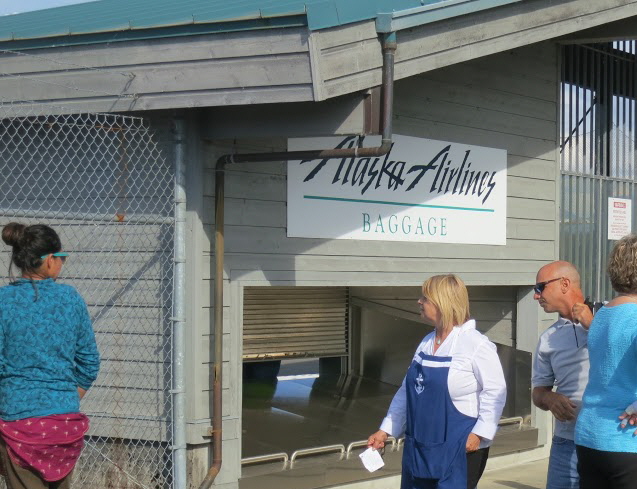
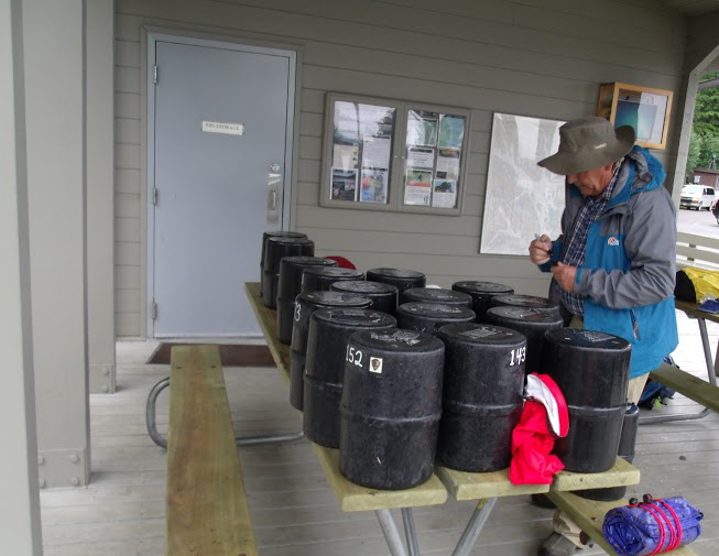
Like many people who travel to Glacier Bay in the summertime, we arrived in Gustavus, AK on the once-daily (in the summer) Alaska Airlines flight from Juneau. 14 minutes after taking off in Juneau, the flight is back on the ground, barely sufficient altitude to distinguish between flying and taxing across the ground. We used TLC Taxi in Gustavus for the pickup at the airport and transportation to the Park Visitor Center. It’s a little expensive ($15/person) but you can count on them and they’ll stop at Toshco (the local store) for last minute things like stove fuel or bear spray. The flight from Juneau gets into Gustavus at 5:10 pm, and after a quick stop at the store, we arrived at the NPS Visitor Center, just after the orientation movie show started (20 minutes long). This was a different production from the one shown 10 years ago, but it has the same theme - “leave no trace”. After a quick orientation from the ranger (he’s was anxious to go home by this time), he filled out the back country pass and assigned us our bear canisters that we needed. For 6 people, with 12 days of food (and not quite enough booze for the trip) we used 19 bear canisters. After packing up all the canisters and putting extra gear in the storage shed near the Visitor Center, we piled our equipment into NPS supplied wheelbarrows and made our way to the Bartlett Cove Campground (1/4 mile to the south, down the beach trail), where in spite of some travel weary bodies and the soft patter of rain, the crew killed a couple pouches of Mountain House dinner before settling down for a little night cap around the fire. |
|||||||||||||||||||||||||||||||||||||||||||||||||||||||||||||||||||||||||
 |
|||||||||||||||||||||||||||||||||||||||||||||||||||||||||||||||||||||||||
|
What passes for a luggage carousel in Gustavus. |
|||||||||||||||||||||||||||||||||||||||||||||||||||||||||||||||||||||||||
 |
|||||||||||||||||||||||||||||||||||||||||||||||||||||||||||||||||||||||||
|
After packing the bear-proof canisters, it’s a good idea to label them with a piece of duct tape and a permanent marker - this beats opening many canisters to find the one you want. (This was a lesson from the 2006 trip), |
|||||||||||||||||||||||||||||||||||||||||||||||||||||||||||||||||||||||||
|
Day 1, June 30, 2006 |
|||||||||||||||||||||||||||||||||||||||||||||||||||||||||||||||||||||||||
|
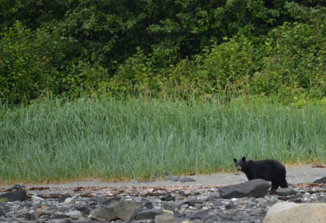
We had two primary goals for the day: to pickup the kayaks and gear, and to paddle around Lester and Young Islands to the west, before entering the Beardslee Entrance at High Tide and proceed into Secret Bay. By 9 am, with a hearty breakfast of flavored oatmeal and a couple of cups of coffee under our belts, the gear was packed in the wheel barrows and we were eagerly waiting for personnel from Glacier Bay Kayaks to show up, give us their briefing and issue our kayaks and rain gear. I had already accepted the fact that we were going to miss the morning high tide, and the easy paddle through the Lester Cut and past the Bartlett River, leaving a short hop into Secret Bay (on the back side of Lester Island). As such, we took our time getting our gear and asking Leah from Glacier Bay Sea Kayaks as much information as we could. After running our wallets up to the lodge for secure storage, we set about packing our kayaks for the first time. Always an arduous task, this was especially difficult the first time around and took at least 45 minutes to get it right. Fortunately, the storage room for unused baggage was just up the hill, as we found out the hard way how much stuff was NOT going to fit in the kayaks. For this trip, we had two double kayaks and two single kayaks. Each of the double kayaks had a fairly experienced guy in the back (Bob and Jim) and a brand new guy in the front (Geren and Dave). In one of the single kayaks we had CW, who took two days of kayaking instruction before the trip. And, because he always wanted to go to Glacier Bay, CW’s instructor Jonathan came along and paddled the other single kayak. After a short lunch, we bundled ourselves into our vessels, closed our eyes and launched. Somehow or another, all six people managed to get two miles across Bartlett Bay without getting wet. Several times during the crossing humpback whales would announce their presence by loudly exhaling out of their exhaust holes. When that didn’t get our attention, they would turn their back to us (show a little dorsal fin) or give us “the tail”. On the back side of Lester Island, we came across our first significant land mammal, a small, 150 pound black bear flipping rocks in the tidal zone for something to eat. Just at high tide, we rounded Young Island and entered the Beardslee Entrance. Between high and low tides, the Beardslee Entrance has a high flow of current and may contain tidal rips. But right at slack tide the current is negligible and easy to paddle in. Camp that night was above a nice steep beach, in a moss and strawberry patch that was not only full of juicy morsels, it was also very comfortable. |
|||||||||||||||||||||||||||||||||||||||||||||||||||||||||||||||||||||||||
 |
|||||||||||||||||||||||||||||||||||||||||||||||||||||||||||||||||||||||||
|
Like most bears we came across, this little Blackie had virtually no interest in our presence. He probably wished to be left alone, in peace and quiet while he searched for yummy things that were hiding under the rocks. |
|||||||||||||||||||||||||||||||||||||||||||||||||||||||||||||||||||||||||
 |
|||||||||||||||||||||||||||||||||||||||||||||||||||||||||||||||||||||||||
|
Even though it’s relatively close to Bartlett Cove, Secret Bay is just remote enough that it’s not visited all that often - a Great Place. |
|||||||||||||||||||||||||||||||||||||||||||||||||||||||||||||||||||||||||
|
Day 2, July 1, 2016 |
|||||||||||||||||||||||||||||||||||||||||||||||||||||||||||||||||||||||||
|
Day 2 wasn’t about seeing a bear, no, Day 2 was just a bear, all by itself. Every time we turned around someone or something was whispering (or shouting) “Just Testing Yah!” A couple of miles out of camp we had to swing off our northerly route and head east to clear some protected, bird-nesting islands. As we cleared the islands to the north, the wind and seas started to pick up quite noticeably. Soon, one foot seas became two footers and two’s became three foot seas with occasional four footers. This was just chop, so there was very little time between swells. Somewhere in the process of crossing this 3 or 4 mile body of water, the current flipped and we started going into a healthy current. The safety of land was tantalizingly close, but only seemed to barely draw closer. As long as the waves were taken head-on or quartered, they weren’t too bad, but everyone had to be careful and not catch one broadsides. Because of a contrary side current, I twice had to tack down wind to stay on course. At long last, we pulled into the lee of an island and left the big seas behind. The remainder of the day was a hard paddle against the wind as we battled our way up the east side of a chain of islands, Just before we rounded the northernmost island of a chain (before searching for a camping spot on the west side), we saw a large black bear in the 400 to 600 pound category. Unfortunately, he didn’t stay in sight long for a picture. We were close to high tide that night when we settled in to camp, so we didn’t have a very long carry for our kayaks and equipment. This island was the one used by the Beardslee family to raise foxes on 80 or 90 years ago. We settled into camp on some nice moss covered with strawberry plants. There was an incredible view across the Sitakady Straights at the west side of the bay. Because it had been raining off and on all day, starting a fire that night was difficult, but there were enough Boy Scouts and cowboys in the crowd that the fire gods at last succumbed and granted us the warmth, cheer and grace of a fire. |
|||||||||||||||||||||||||||||||||||||||||||||||||||||||||||||||||||||||||
 |
|||||||||||||||||||||||||||||||||||||||||||||||||||||||||||||||||||||||||
|
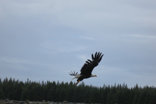
This place has more Bald Eagles than Central Park has pigeons. We have quite a few at home in Oregon too, but I like Golden Eagles better. They’re significantly bigger than their bald buddies. When a Gold Eagle shows up, the Baldies all seem to disappear. |
|||||||||||||||||||||||||||||||||||||||||||||||||||||||||||||||||||||||||
 |
|||||||||||||||||||||||||||||||||||||||||||||||||||||||||||||||||||||||||
|
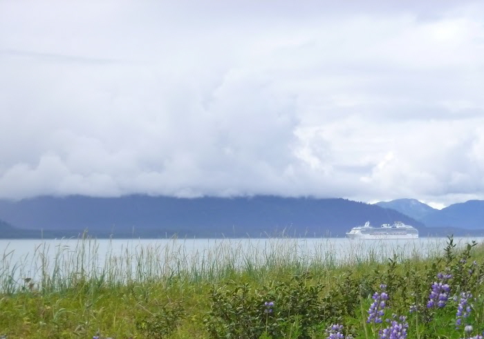
One of the two daily cruise ships allowed in Glacier Bay. Our campsite view to the west, across the Sitakady Straights is a pretty one. |
|||||||||||||||||||||||||||||||||||||||||||||||||||||||||||||||||||||||||
 |
|||||||||||||||||||||||||||||||||||||||||||||||||||||||||||||||||||||||||
|
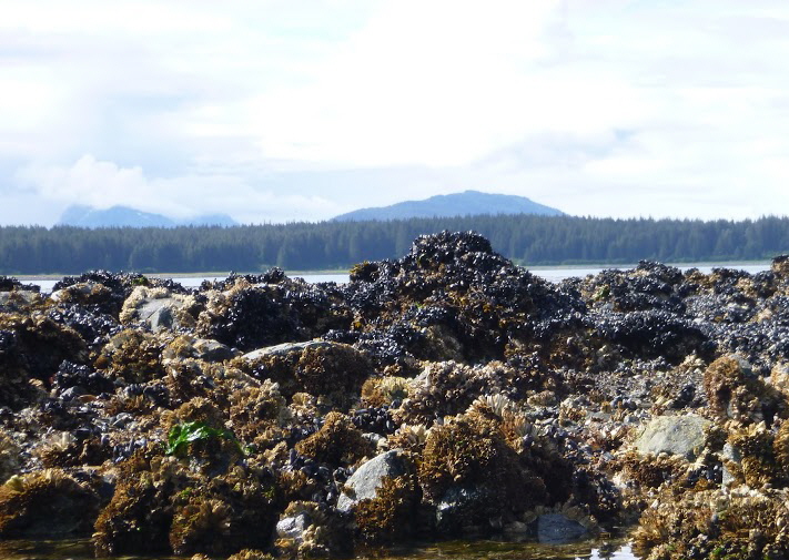
With 20 to 25 feet spring tides, Glacier Bay has large tidal zones. The mussels in this photo are capable of surviving out of water for a few hours. This allows them to exist in waters that their big enemy, the starfish can’t live in (all they have to do is hold their breath for a while)! |
|||||||||||||||||||||||||||||||||||||||||||||||||||||||||||||||||||||||||
|
Day 3, July 2, 2016 |
|||||||||||||||||||||||||||||||||||||||||||||||||||||||||||||||||||||||||
|
It was an early wake up for a long day of paddling. Calm wind, mild temperature and no rain, a perfect day to paddle across the bay and start trekking north. Little did we know, we were just starting an incredible stretch of weather. For the remainder of our trip, we had no rain and mostly sunny skies. Hey, did I wake up and find myself magically teleported to the south shore of Kauii? This day and the next ones were to be our longest travel days of the trip. Three things that will affect where you paddle and how far you go are; the tidal currents, the weather forecast, and the wind. Knowing these three things help determine paddle times in this fashion. 1. Go up bay on the flood, down bay on the ebb, and across bay at slack time. 2. Ignore the weather report or assume the exact opposite - it’s wrong more than right. 3. Get out of the sack and move early - this is usually a much better time of day to travel as there is less wind. When we broke camp and started carrying our self down the beach, we were not happy about the long carry. It took 20 to 30 minutes longer than normal to get everything loaded up. But, by the time we started across the straights things were really looking up - the sun was coming out, the water was like glass and there was virtually no current. For the next few hours we enjoyed the antics of sea otters, seals and humpback whales, all of which were present in large numbers and we paddled across the bay to a point just south of Willoughby Island. By the time we rounded the west end of Willoughby Island and floated into the Whidbey Passage, the flood tide was picking up and carrying us up the bay quite well. We bypassed Fingers Bay and continued north towards Geike Inlet. Just north of Fingers Bay is a large amount of Interstadial stumps that survived the mini-ice age. In another generation or two, these relics will probably be gone. We pulled into one of my favorite camping spots on the northeast corner of Geike Inlet. It was too early for the salmon run on the large stream there, but the Dolly Varden were cruising the gravel beach looking for salmon fingerlings, and Dave caught us a couple of nice ones for supper. Just after we got to the campsite, a humpback started feeding and hanging out about 200 feet from camp.
|
|||||||||||||||||||||||||||||||||||||||||||||||||||||||||||||||||||||||||
 |
|||||||||||||||||||||||||||||||||||||||||||||||||||||||||||||||||||||||||
|
During the salmon run, you can walk across the fish in this creek, however that’s a few weeks down the road. |
|||||||||||||||||||||||||||||||||||||||||||||||||||||||||||||||||||||||||
 |
|||||||||||||||||||||||||||||||||||||||||||||||||||||||||||||||||||||||||
|
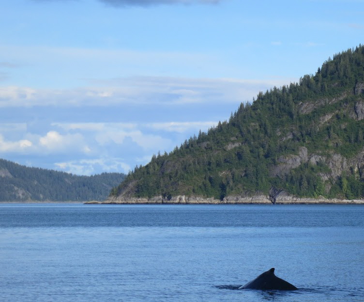
This smaller humpback whale (30 to 40 feet long) either enjoyed company or had some good fishing. He hung around just offshore (about 200 feet from the bear canisters) for about 15 minutes. |
|||||||||||||||||||||||||||||||||||||||||||||||||||||||||||||||||||||||||
 |
|||||||||||||||||||||||||||||||||||||||||||||||||||||||||||||||||||||||||
|
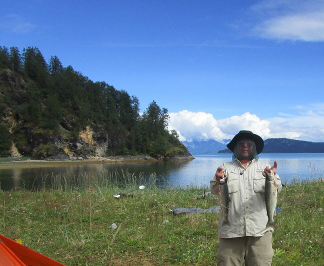
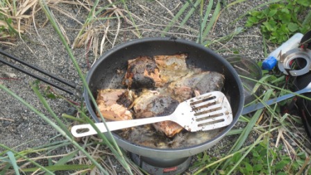
A couple of nice Dolly Varden that Dave caught for our dinner. |
|||||||||||||||||||||||||||||||||||||||||||||||||||||||||||||||||||||||||
 |
|||||||||||||||||||||||||||||||||||||||||||||||||||||||||||||||||||||||||
|
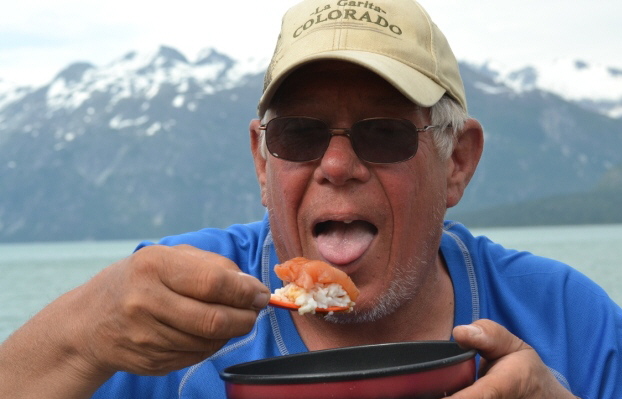
After paddling 127 miles and living outdoors for two weeks, you would think that we would have all lost weight on the trip. Not so - as far as I know all six of us either gained weight or remained the same - We ate good! |
|||||||||||||||||||||||||||||||||||||||||||||||||||||||||||||||||||||||||
|
Day 4, July 3, 2016 |
|||||||||||||||||||||||||||||||||||||||||||||||||||||||||||||||||||||||||
|
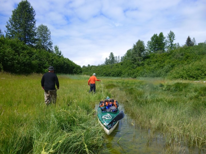
Another long day was planned on this one, so we were off to another early start. The paddle north is along the flank of Hugh Miller Mountain. Narrow waterfalls cascaded down steep, glacier scoured, granite cliffs was the shoreline view for the next few miles as we paddled north. Not long after paddling into Hugh Miller Inlet we stopped for lunch. Just before entering Skidmore Bay, at the point where Hugh Miller Bay, Skidmore Bay and Charpentier Inlet all come together, we encountered a strong, swirling current that caused some problems for at least one of the boats. After pushing through this eddy, we entered Skidmore Bay and began the long paddle up bay to the Skidmore Cut (a 3/4 mile long isthmus that floods up with a narrow channel to the West Arm of the bay at very high tides). Skidmore Cut Information: In order to cross the Skidmore Cut without having to portage the kayak and gear, it must be crossed at a higher than normal high tide. Specifically - the kayaker needs 15.2 feet of water (as shown on the Willoughby Island tide tables. Note the high tide at the cut is 1/2 hour past the time shown on the Willoughby tables). The southern 1/3 of the cut is 2 to 3 feet shallower than the northern 2/3. So if you are starting from the north or West Arm end of the cut, you only need 13 feet of water to pass through the first 2/3 of the cut before you reach the dry portions of the cut. When the tide rises to 15.2 feet, you can walk and tow your kayak and gear through the remainder of the cut. If the tide comes all the way up to 16 feet, you can paddle the whole thing. I took the time to explain this as so many people use this route and the information does not appear to be present on the internet. I planned this trip so we would be close enough to the spring high tide to have sufficient water to tow the kayaks through the cut. For once, good planning prevailed and everything worked out exactly like I wanted it to. We arrived 45 minutes early for the high tide and the end of the cut was sealed as tight as a cork in a champagne bottle. While I was softly cussing and nervously scuffing the ground with my toe over the lack of water, the gravitational pull of the moon and sun combined to lift the water just over narrow neck of land that was blocking the southern approach to the cut. This is the second time I had traveled this route, but I still caught my breath when I rounded the last curve in the cut and the incredible panorama of the West Arm exploded into view in front of me. The smooth finish of the sea was such a perfect surface, the reflection of the snow covered granite peaks was just as sharp as the real mountains (only inverted). After gawking at the scenery for a while, we turned the kayaks to the northeast for the two mile run to our campsite. |
|||||||||||||||||||||||||||||||||||||||||||||||||||||||||||||||||||||||||
 |
|||||||||||||||||||||||||||||||||||||||||||||||||||||||||||||||||||||||||
|
Towing loaded kayaks through the southern 1/3 of the 3/4 mile long Skidmore Cut. With the land rising from Glacial Rebound at 1-2 inches per year, my grandchildren need to grow up quick if they want to use this route! |
|||||||||||||||||||||||||||||||||||||||||||||||||||||||||||||||||||||||||
 |
|||||||||||||||||||||||||||||||||||||||||||||||||||||||||||||||||||||||||
|
Popping out the northern end of the Skidmore Cut. It’s like floating through a warp in time and space and entering another dimension. |
|||||||||||||||||||||||||||||||||||||||||||||||||||||||||||||||||||||||||
|
Day 5, July 4, 2016 |
|||||||||||||||||||||||||||||||||||||||||||||||||||||||||||||||||||||||||
|
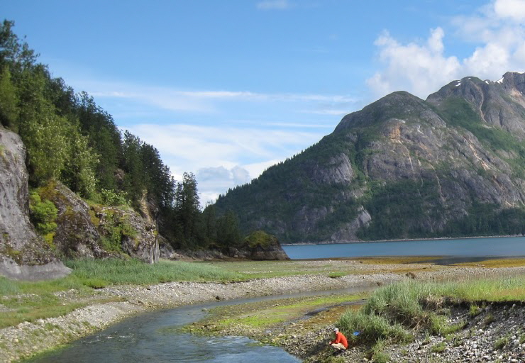
We rose that morning to a great day. Not only the 240th anniversary or our nation, but also a beautiful day in an extremely special place in the world. With only 10 miles to paddle, we had a leisurely breakfast of blueberry pancakes, and took our time breaking camps. The plan was to find a nice camping place near the mouth of Tarr Inlet and settle in for the 4th of July festivities. We crossed the West Arm at slack high tide and with calm winds. The vistas were incredible. Before proceeding up the shoreline to the west, we stopped at a beautiful, rushing, stream of snow melt. After cascading down several thousand feet of rock and sand, the water was as pure and soft as any I have ever experienced. With water like that, I had to grab my shaving kit and towel and work on my personal hygiene (a nice stop). The paddle up the bay was beautiful. Except for some wispy clouds near the peaks of the taller mountains, the sky was crystal clear and the only thing possibly obstructing the distance you could see was the asteroid belt! Opposite the west end of Russell Island, we found a great camping place on the north shore of the West Arm. For once we had a nice relaxing afternoon with plenty of time to catch up on chores like organizing gear, drying out the odd pair of socks or turning the pages of a ratty copy of a Louis L’amour novel. The strawberries were ripe wherever I turned, so gathering a handful didn’t require any walking, just rolling over on another side. After supper, our thoughts started turning to those fine men two and a half centuries ago who were tired with King George III taxing their grog and whiskey, and decided to do something about it. So in the finest of American traditions, we broke out the grog and whiskey, built a good fire and discussed the trespasses of King George. It was rumored that when a vessel turned in close to shore, near the fire to check out the festivities, that three very Full Moons suddenly rose above the horizon near the fire, but don’t worry, I think it’s just a rumor. |
|||||||||||||||||||||||||||||||||||||||||||||||||||||||||||||||||||||||||
 |
|||||||||||||||||||||||||||||||||||||||||||||||||||||||||||||||||||||||||
|
A really nice camp for the 4th of July. There was a lot of Grizzly scat, but Geren, the rancher in the party let us know it was all more than two days old. That’s about as good as it gets in this neck of the woods. |
|||||||||||||||||||||||||||||||||||||||||||||||||||||||||||||||||||||||||
 |
|||||||||||||||||||||||||||||||||||||||||||||||||||||||||||||||||||||||||
|
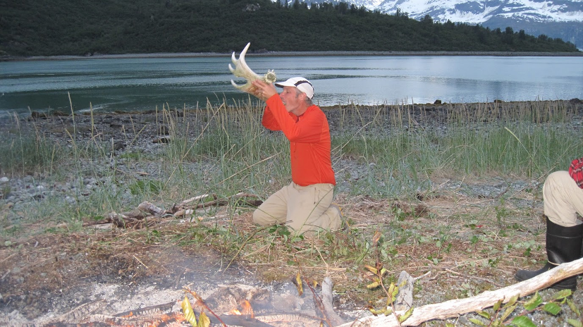
I’m told that it’s a time-honored Alaskan tradition to swill your grog from a moose horn on the 4th of July. |
|
Day 6, July 5, 2016 |
||||||||||||||||||||||||||||||||||||||||||||||||||||||||||||||||||
|
Soon after leaving camp, we paddled around the corner and started up Tarr Inlet, on the way to see our first two tidewater glaciers. An hour after starting out, we were paddling close to the north show of the inlet when we came upon are first brown bear. A 600 to 650 pound bear was flipping rocks in the inter-tidal zone, looking for a bite to eat. We stayed near this guy 10 or 15 minutes and he paid absolutely no attention us; I don’t think he looked up once, even as he was flipping 200 pound rocks like they pebbles. Originally I had planned on camping on the north shore, alongside the Grand Pacific Glacier. However, as we got closer, this place didn’t look too promising through a set of binoculars, so we opted for Plan B, a piece of shore near by a stream inlet, one mile east of Margerie Glacier and directly facing it from the south shore of the inlet. The only bad thing about this camping place was that tide ran across a fairly shallow pitched shelf of beach between high and low tide. This would mean a long walk with the kayak and gear, except under one condition, land at high tide and launch in the morning at high tide - that’s what we did. \ The Grand Pacific Glacier is very big, very brown (full of dirt) and not very active. For that reason, it’s probably the least popular tidewater glacier in the bay. The Margerie Glacier is accessible, white and very active, making it very popular with tourists. After a pair of cruise ships and a couple of site-seeing boats made their appearance in the afternoon, we had the place to ourselves. We scheduled an early wake up for the next morning to catch the high tide, so we decided to wait until then to take the kayaks closer to the Margerie Glacier. So everyone would get a good night sleep on a full belly, we made up a double portion of Indian Fry Bread for supper (with cinnamon and sugar), A note on this campsite - bring your water with you. The only stream close enough to get water is glacial fed and runs muddy. |
||||||||||||||||||||||||||||||||||||||||||||||||||||||||||||||||||
 |
||||||||||||||||||||||||||||||||||||||||||||||||||||||||||||||||||
|
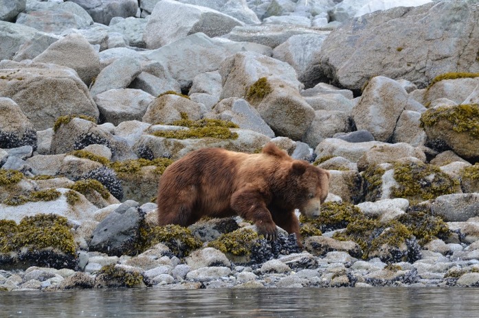
To give you some perspective of size, this grizzly stood about 3 feet at the shoulder, with claws about 4 inches long. He didn’t have a care in the world (certainly not us). While he appears peaceful, I never forget that he’s the largest land carnivore in North America, capable of breaking the back of a bull moose with a single swipe of his paw. However, even with that in mind, it’s nice to be able to travel somewhere where man is not necessarily at the head of the food chain. There is such a thing as a world that’s too tame! |
||||||||||||||||||||||||||||||||||||||||||||||||||||||||||||||||||
 |
||||||||||||||||||||||||||||||||||||||||||||||||||||||||||||||||||
|
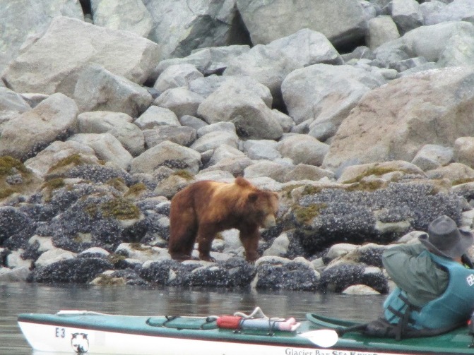
This shot looks like Geren and Jim are about to extend an invitation to their four-legged friend for a kayak ride, but, I’m a devil with a telephoto lens. The bear is actually 50 or 60 feet from the kayak. |
||||||||||||||||||||||||||||||||||||||||||||||||||||||||||||||||||
 |
||||||||||||||||||||||||||||||||||||||||||||||||||||||||||||||||||
|
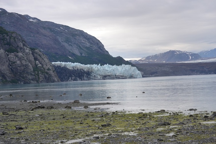
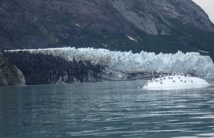
Gleaming white Margerie Glacier on the left and what looks like a low brown hill on the right (this is actually dirty, old Pacific Glacier). This is the view from our campsite. All day and night long there was a sound like loud thunder which actually was large chunks of ice calving off the glacier and falling into the sea. If you kayak closer than 1/4 mile, you have to careful not to be bowled over by iceberg waves that frequently are bigger than 3 to 4 feet. |
||||||||||||||||||||||||||||||||||||||||||||||||||||||||||||||||||
 |
||||||||||||||||||||||||||||||||||||||||||||||||||||||||||||||||||
|
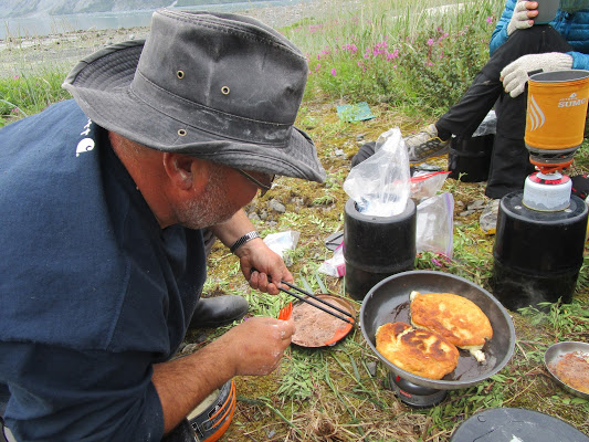
Flour, baking powder, water, olive oil to fry it in, and an appetite - that’s all you need for Indian Fry Bread. If you want it rolled in sugar and cinnamon like the Navajo’s do, it’s even better. |
||||||||||||||||||||||||||||||||||||||||||||||||||||||||||||||||||
 |
||||||||||||||||||||||||||||||||||||||||||||||||||||||||||||||||||
|
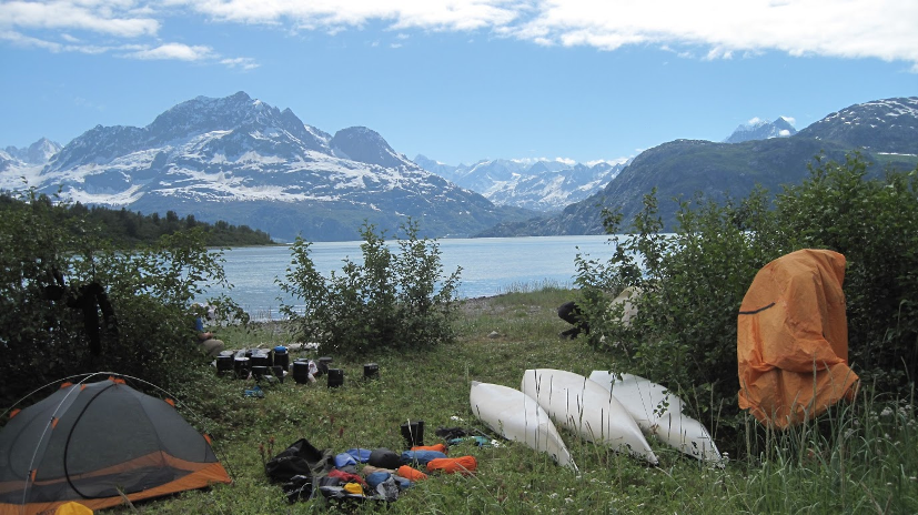
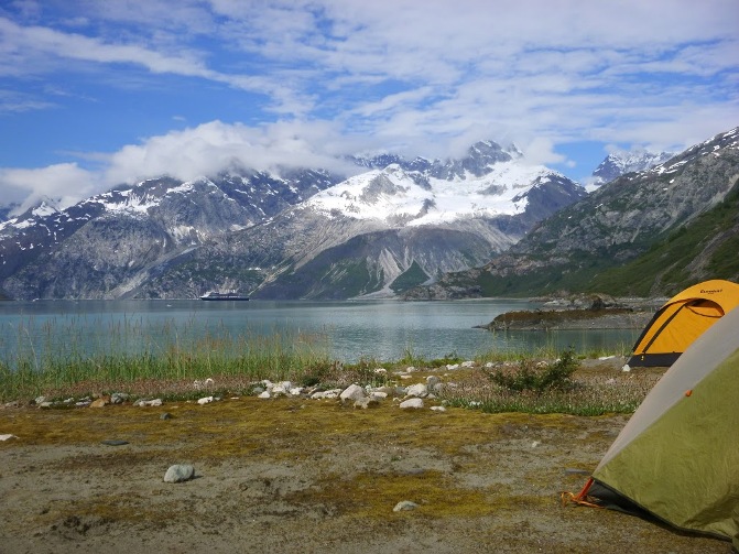
Our camp in Tarr Inlet - a nice place. |
||||||||||||||||||||||||||||||||||||||||||||||||||||||||||||||||||
 |
||||||||||||||||||||||||||||||||||||||||||||||||||||||||||||||||||
|
A closer view of Margerie Glacier taken from the kayak the next morning |
||||||||||||||||||||||||||||||||||||||||||||||||||||||||||||||||||
|
Day 7, July 6, 2016 |
||||||||||||||||||||||||||||||||||||||||||||||||||||||||||||||||||
|
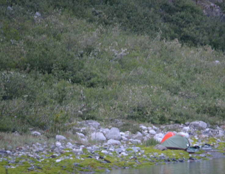
With the Tarr Inlet glaciers behind us, it was now time to move on to the crown jewel of the Trip - John Hopkins Glacier. The weather continued to be good, morning clouds, giving way to afternoon sunshine. Fortunately we managed to break camp right after high tide. If we had slept in an hour we would have had to carry our stuff a long way down the beach. After shoving off, we paddled to within 1/4 mile of the glacier. Any closer than this and we might have to worry about berg-waves or shooters. Shooters are pieces of the iceberg that can shoot out underwater, sometimes for several hundred feet. We had pulled out early so the daily cruise ships that motor up Tarr Inlet weren’t due until after we had paddled back out. After clearing Tarr inlet a two mile wide channel of water forms the start of John Hopkins inlet. On the opposite side of this channel is Lamplugh Glacier. A fairly inactive glacier that is a tidewater glacier except at low tide, when most of the glacier is grounded. After exiting Tarr inlet, we made a right turn and paddled a mile or two down the coast until we came to position right across the water from Lamplugh Glacier. A couple of hours after we set up camp, a large group of Japanese tourist stopped to camp. The only good ground available was across a small creek and only had a couple of flat places to camp. Some people stayed and some went on to another campsite. One of the pictures below shows what happened when they set a tent too close to the high tide line. |
||||||||||||||||||||||||||||||||||||||||||||||||||||||||||||||||||
 |
||||||||||||||||||||||||||||||||||||||||||||||||||||||||||||||||||
|
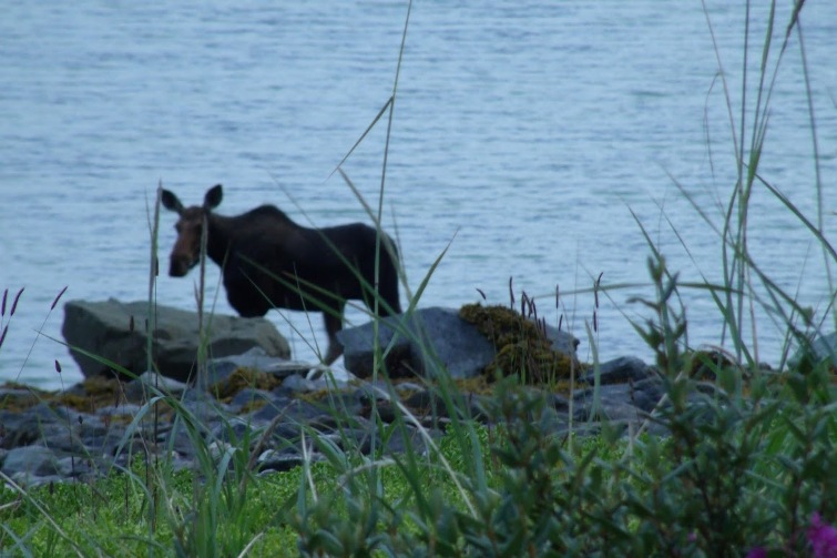
My buddy Geren was totally out of his comfort zone on this trip. Normally, at this time of the year he’s up in the high country chasing cows on horseback. But even here in the wilds of Alaska nature provided him with a measure of comfort - a cow (well, a cow moose). Reaching the water, she looked back at Geren, winked one her long curved eyelashes, then dove into the bay, As she was swimming the two miles to the opposite shore, she kept glancing back longingly, hoping he would follow her sirens call and chase her into the water. |
||||||||||||||||||||||||||||||||||||||||||||||||||||||||||||||||||
 |
||||||||||||||||||||||||||||||||||||||||||||||||||||||||||||||||||
|
A few minutes before this picture was taken, the water was higher and actually lapping into the tent. I think are Asian neighbors were less than pleased at how high the tide came in. |
||||||||||||||||||||||||||||||||||||||||||||||||||||||||||||||||||
|
Day 8, July 7, 2016 |
||||||||||||||||||||||||||||||||||||||||||||||||||||||||||||||||||
|
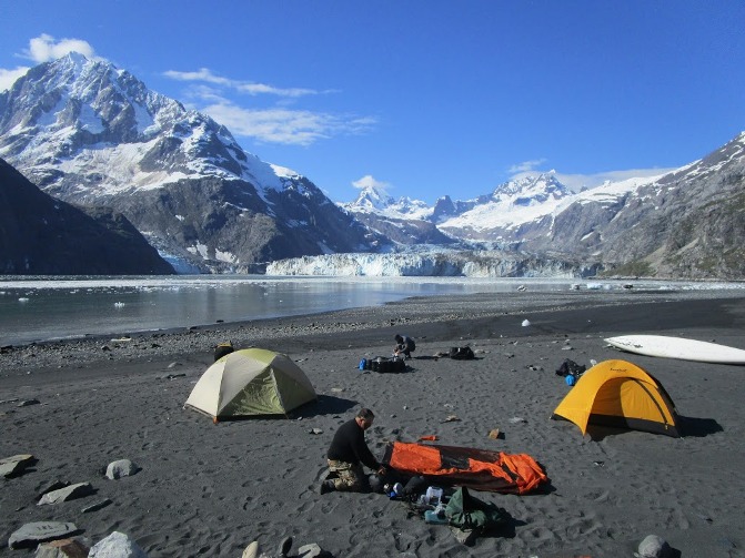
To avoid some of the pack ice, I wanted to go up John Hopkins Inlet on the ebb tide. This allowed a more leisurely departure than the one we had made in Tarr Inlet, the day before. Once underway, it was a three mile paddle to Jaw Point, which is the real start of John Hopkins Inlet. At the back of the inlet a huge glacier winds it way out of snow covered, rocky peaks, before dumping into the ocean. The sides of the inlet are enclosed in nearly shear cliffs of granite, lifting several thousand feet into the sky. On both sides of the inlet, several small glacier cascade down the granite cliffs, stopping short of falling into the sea. In North America, there’s truly no where else like John Hopkin Inlet. Ten years ago, we had tried to travel into the inlet, but could only get about two miles before the pack ice got too thick to safely navigate through. (Back in 2006 we must have caught the wind and tide exactly wrong, because you can usually pick your way through the ice). On this day in 2016, we must have caught it exactly right as there was hardly an ice cube in sight. It was a smooth paddle all the way back to the black sand beach, a mile in front of the glacier. By 10 am we pulled our boats on to the beach and looked around for a campsite. Since it was few days past the spring tide that was associated with the new moon, high tide was now 3 feet lower than the maximum a few days ago. This allowed us to camp on the higher sections of sandy beach without moving our tents on to the rockier ground up above. There was no wind, not a cloud in the sky and the temperature well into the 60’s. This kind of weather probably only makes an appearance two or three times a year in John Hopkins Inlet. What a perfect day to visit one of the most perfect places on earth, and we enjoyed it the most we could. Around 8 pm the sun set behind the wall of the inlet. Almost within minutes, the temperature dropped about 30 degrees and every retreated to their sleeping bags. |
||||||||||||||||||||||||||||||||||||||||||||||||||||||||||||||||||
 |
||||||||||||||||||||||||||||||||||||||||||||||||||||||||||||||||||
|
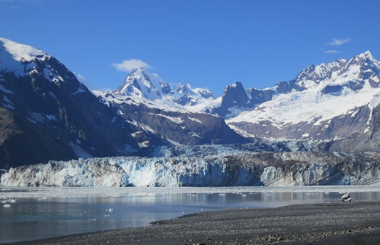
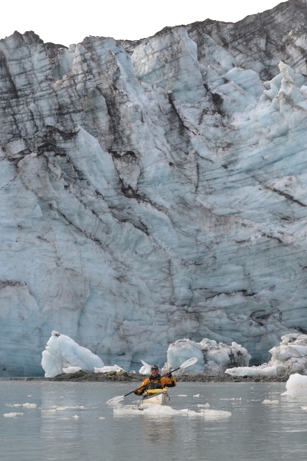
John Hopkins Glacier is a little more than a mile across and a mile in front of our camp on the black sand beach. All day and night long, large chunks of ice calve off the front of the glacier and drop into the bay. You have to be looking right at the glacier to see the calving occur. By the time the large crack and boom of the sound reach you on the beach, the event had already occurred five seconds earlier. |
||||||||||||||||||||||||||||||||||||||||||||||||||||||||||||||||||
 |
||||||||||||||||||||||||||||||||||||||||||||||||||||||||||||||||||
|
I’ve never camped at a nicer place. There might be better places, but I’ve never set a tent in one. |
||||||||||||||||||||||||||||||||||||||||||||||||||||||||||||||||||
 |
||||||||||||||||||||||||||||||||||||||||||||||||||||||||||||||||||
|
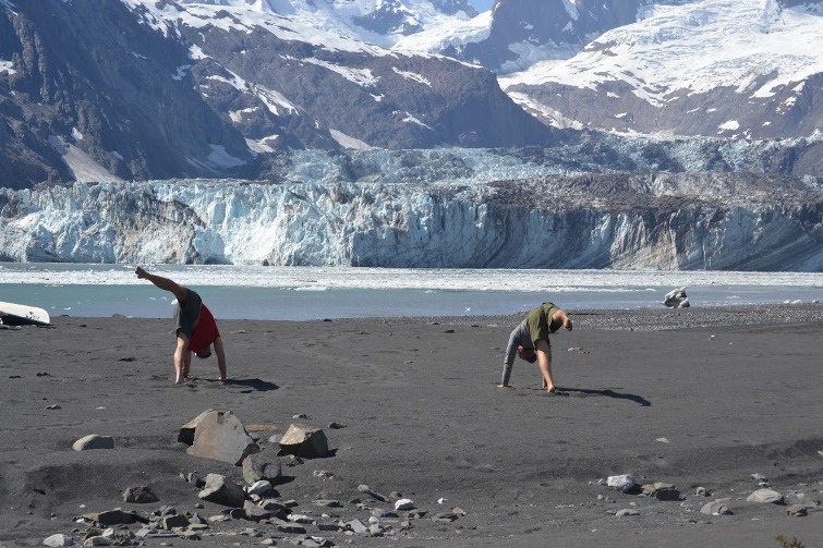
This might be a first in Glacier Bay as Jim and CW practice Yoga on a beach in shorts and bare feet, right next to one of the most active glaciers in North America. |
||||||||||||||||||||||||||||||||||||||||||||||||||||||||||||||||||
|
Day 9, July 8, 2016 |
||||||||||||||||||||||||||||||||||||||||||||||||||||||||||||||||||
|
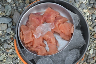
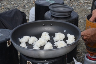
The morning once again brought clear skies and a warm temperature. I planned our departure for at least two hours into the ebb, but we got in a hurry and started down the inlet before the ebb had time to spread out the pack ice. When the kayaks were finally packed, we started down the inlet in light to moderate ice. About a mile from our camp the ice started getting thicker and we had to search out leads through the floes. Occasionally, my thoughts turned to the early Antarctic explorers, trapped in the sea ice for months and years at a time. With the thin fiberglass shells on the kayaks, we would only last about 5 seconds in a good squeeze. But, it never got nowhere near that bad and we always managed to find plenty of leads in the ice to paddle through. After pulling free of the ice and rounding Jaw and Confusion Points, we set our sights on Lamplugh Glacier, 2 miles ahead. We didn’t know it at the time, but a week previous, on the day before we arrived at Glacier Bay, Lamplugh glacier had a tremendous landslide fall on it during an earthquake. It’s estimated that 165 million tons of rock fell on the glacier (I bet that made it groan!). When I was here last, and in every picture of Lamplugh Glacier that I have seen, the large outflow stream of water from the glacier came from an ice cave in the center of the glacier. Now the outflow is coming from the far right side of the glacier. I have no idea if this occurred during the landslide - probably not. Leaving Lamplugh, we made our way a couple miles east to Ptarmigan Creek, our campsite for the night. After setting up camp, we tried our hand at fishing. Dave scored once more and managed to land a nice Dolly Varden. I had some left over white rice and soy sauce, and we had access to plenty of floating glacial ice, so we decided to make some nigiri style sushi - I’ve never tasted finer. This was Geren’s and Dave’s first taste of Sushi and they loved it. |
||||||||||||||||||||||||||||||||||||||||||||||||||||||||||||||||||
 |
||||||||||||||||||||||||||||||||||||||||||||||||||||||||||||||||||
|
Jim and Geren picking their way through the pack ice in John Hopkins Inlet. |
||||||||||||||||||||||||||||||||||||||||||||||||||||||||||||||||||
 |
||||||||||||||||||||||||||||||||||||||||||||||||||||||||||||||||||
|
Jonathan, in front of Lamplugh Glacier. The telephoto lens makes him look closer that he is. |
||||||||||||||||||||||||||||||||||||||||||||||||||||||||||||||||||
 |
||||||||||||||||||||||||||||||||||||||||||||||||||||||||||||||||||
 |
||||||||||||||||||||||||||||||||||||||||||||||||||||||||||||||||||
 |
||||||||||||||||||||||||||||||||||||||||||||||||||||||||||||||||||
|
Back country Nigiri. Who would have thought that all the ingredients would come together to make it possible. We even had ice to cool down the fish and rice, glacial ice that was probably frozen at the time Jesus was giving The Sermon On the Mount. |
||||||||||||||||||||||||||||||||||||||||||||||||||||||||||||||||||
|
Day 10, July 9, 2016 |
||||||||||||||||||||||||||||||||||||||||||||||||||||||||||||||||||
|
For our last full day in the back country, we planned on spending a good part of the day in the Reid Glacier Inlet. In the old days, not long after glaciers from the mini ice age had retreated, the land was similar in appearance to John Hopkins Inlet, largely devoid of vegetation. Today, nearly all of the land in the upper bay is covered by a thick carpet of alder trees which create a tough tangle of both vertical and horizontal growing branches. Until the spruce trees of a more mature forest begins to replace alder, the upper bay will be largely cutoff from hiking. It used to be a short walk from Ptarmigan Creek to the old Ibach cabin in Reid Inlet. Today it would be a mess, a tangled up scramble that would take hours. Now the only practical way of travel to Reid Inlet is by kayak. Not too many people come to Glacier Bay to hike! Our first stop after pulling into the inlet was to stop and see what remained of the old cabin of Joe and Muz Ibach. Joe and Muz were the last miners to live in the bay and resided every summer in a cabin in Reid Inlet while Joe worked a mine of his, over the hill in Ptarmigan Creek. When the Ibach’s moved into the inlet in 1924, the face of Reid Glacier was only 1/2 mile from the cabin. Today, the glacier is about 2 1/2 miles away. Both the cabin and the shed had deteriorated a lot in the previous 10 years since I last saw it. In another 10 years, I’ll have a hard time seeing anything at all. Reid Glacier is fully grounded, not far from the water and pretty stable. We took about an hour walking around the base of glacier before heading out. Our destination for the night was the site of our 4th campsite on the journey, 2 miles west of the Skidmore Cut. |
||||||||||||||||||||||||||||||||||||||||||||||||||||||||||||||||||
 |
||||||||||||||||||||||||||||||||||||||||||||||||||||||||||||||||||
|
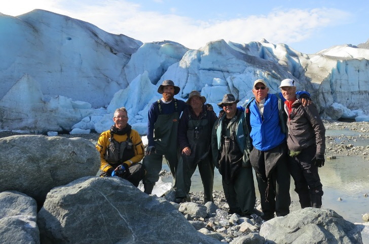
The whole crew from left to right - Jonathan, CW, Bob, Geren, Dave & Jim in front of Reeds Glacier |
||||||||||||||||||||||||||||||||||||||||||||||||||||||||||||||||||
|
Day 11, July 10, 2016 |
||||||||||||||||||||||||||||||||||||||||||||||||||||||||||||||||||
|
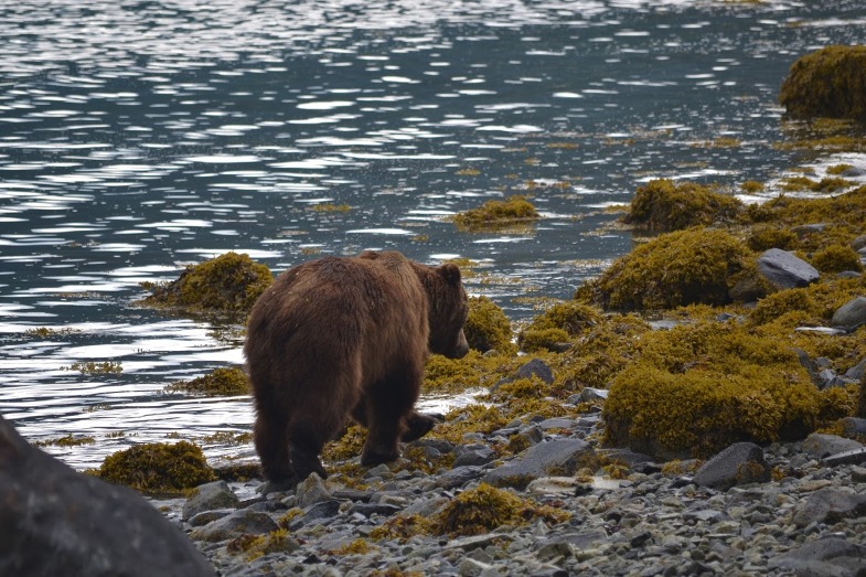
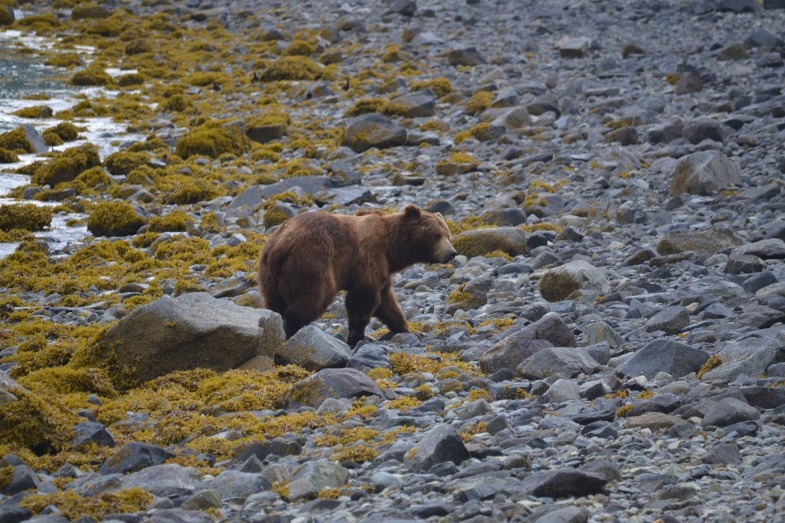
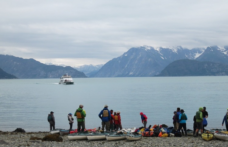
We only had a short run to our pull out point by the Motor Vessel “Barnof Wind”. To take advantage of the short walk with all the gear at high tide, we pulled out at high tide and paddled the last two miles to the gravel beach 1/2 mile west of the Skidmore Cut. After unloading the kayaks, I started cooking up some breakfast. After finishing with breakfast, we had just gotten the plates clean and the bear canisters repacked when Jonathan said, “Guys, I think we have a bear problem”. Looking up at the large Brown Bear, walking between us and the shore, about 30 or 40 feet away, I replied, “We don’t have a bear problem, we have a bear.” Dave was facing the wrong direction and fairly deaf, so I didn’t waste a breath, but used my finger to motion him to the rest of us. As we contracted into a group, we looked bigger to the bear so he started moving off. He went down the beach about 100 yards and settled in on a strawberry patch, where he remained for the next hour. A week earlier, this section of the coast was closed to camping after a kayaker let a bear get a hold of a frying pan full of food. Judging by this bear’s action he was probably the same bear. He wasn’t aggressive, but the smell of our breakfast probably brought him in. With the food put away and us contracting into a group, he moved on pretty good. Geren put his weight at 750 pounds. It’s funny but he looked a lot bigger when he’s standing on the same piece of ground with nothing but air in between. After a lot more kayaker arrived for pickup, the boat finally showed up and we loaded 18 kayaks, 25 kayakers and a lot of gear. That night, we enjoyed a hot shower, a good kitchen cooked meal and a warm bed at the lodge. It was several days before I got used to living and sleeping indoors. On the boat ride back to Bartlett cove I spent 3/4 of the time standing outside on the deck. |
||||||||||||||||||||||||||||||||||||||||||||||||||||||||||||||||||
 |
|
It took me a minute to get my camera out of my case, so by that time he was already 50 or 60 feet down the beach. |
 |
|
In this picture he’s far enough away that he decided to angle up the beach towards the strawberry patch. |
 |
|
Phew, that saves 2 1/2 days of paddling with only one day of food left! |
|
Day 12 and the Aftermath |
|
Well, it doesn’t take long before the trappings of civilization once more adorn a man. The shower, hot meal and soft bed were nice, but I would have also enjoyed heading back out on the water with some clean clothes and fresh food. Oh well, there’s always a next time. At 3:45 pm, we took the free lodge shuttle to the airport. After a chaotic scene with the airline and TSA at the dinky little airport terminal, everyone got processed and aboard the aircraft. At 6 pm and on time the plane blasted off for the 14 minute flight to Juneau. Geren and I then spent the next 16 hours flying all over the place before getting back to Oregon. How can I sum up the trip - “Fantastic, truly fantastic”. |
| [Home] [Trip 5] [When the Weather Breaks -] [A Few Day Roadtrip] [In Memory] [Cuttting Cows and Training] [Trout and Horse Driving] [Brandin' Calves] [Three Weeks To Go] [Wagon & Trailer Work Done] [Things Are Coming Together] [Shakedown In the Mountains] [Scouting Trip] [Tough Start] [Whoa!] [Cattle Drive - Day One] [Cattle Drive - Day Two] [Sweet Summer Days] [Warm, Horsey Days] [An American Serengeti] [In Nebraska, Once Again] [Back Home, At Last] [Happy 2015] [What's New With the Teamster?] [A Long Time Between Posts] [Nice Times] [Twelve Wonderful Days In Glacier Bay] [Catching Up] |